Kings Canyon National Park Trip Cut Short

Kings Canyon National Park Trip Cut Short

Thank you for reading this week’s post on Kings Canyon National Park trip cut short. Again, the place was fantastic, and visiting highly recommended!

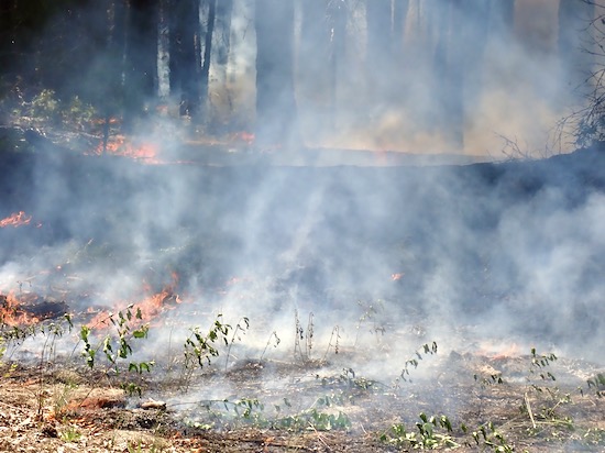
On our way back to Maxx’s from Lassen Park last week, he called to tell us he and Catalina were both sick with flu-like symptoms. My pulmonologist told me that people with fibrosis seldom die from fibrosis. They get a cold or flu, then develop pneumonia. That’s what does them in. So Maxx’s call did not deliver welcome news.

We decided to camp in Maxx’s yard for two nights. We’d then leave Sunday, two days earlier than planned, to go to King’s Canyon and Sequoia Parks. Great plan! I did not go into their house, nor was there any physical contact, and any discourse happened with masks on.

Sunday morning we drove south, as pleasant a drive as you’re likely to get on CA-99, then headed east on CA-180 from Fresno. Soon the van was climbing mountains again, doing switchbacks and hairpin turns. I think I’m finally getting used to them!

We found our site at Princess Campground and had lunch. I wanted to go Do Stuff, but Susan said, “I think we should just hang out and relax.” I didn’t like that idea (at all) but it wasn’t worth arguing about, especially when you know you can’t win anyway. So I wrote some travelogue pieces for Global Outdoors , which whiled away most of the afternoon.

…but Gollum and the evil wargs…

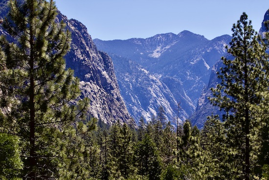
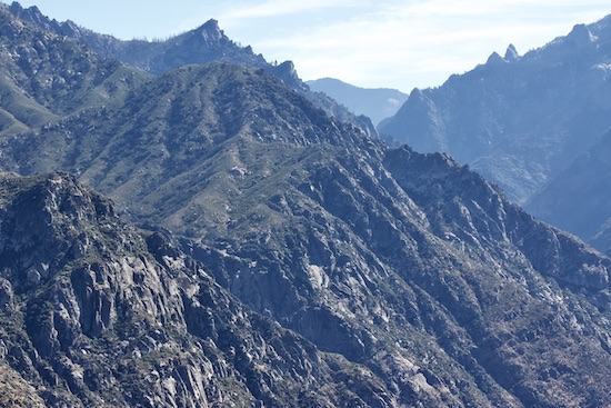
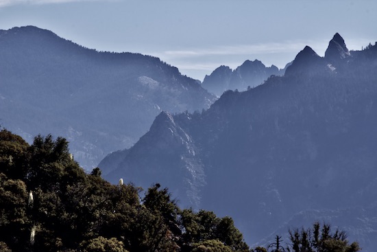
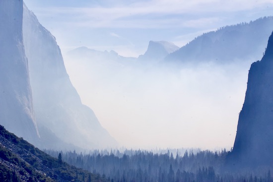
In the morning we got our usual civilized start, leaving for Kings Canyon about 10 AM. Missed the best light again! The descent into the canyon was almost otherworldly. You could imagine Orcs, Dwarves, and Elves having massive battles in terrain like this, at the very edge of Mordor. Super cool!

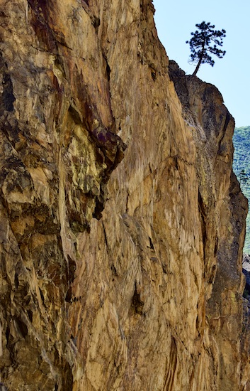
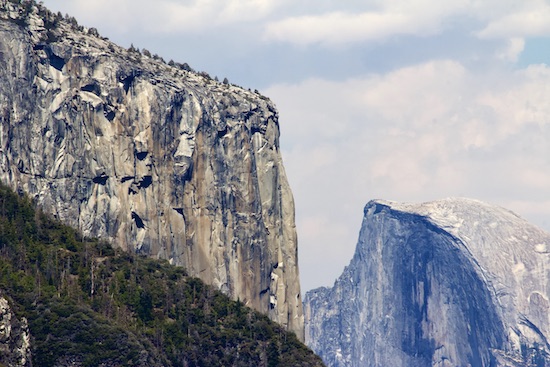
If you drive much out west, you’ll see lots of signs warning you about falling rocks. Well, yeah, the roads cling to cliffs! We came around one bend and there was a wheelbarrow-sized boulder on the centerline, apparently freshly fallen. Glad I wasn’t there ten minutes earlier!

Believe it or not, the road is at the bottom of this cliff, out of the frame.


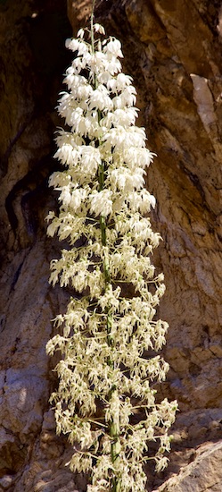
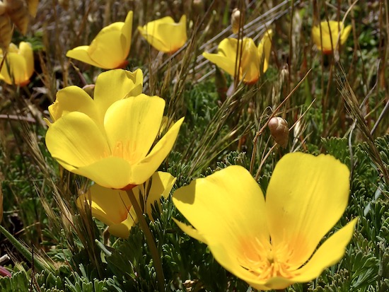
This type of yucca grows all through the canyon.


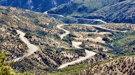
Here’s CA-180, once it’s away from the cliffs.

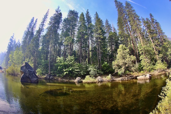
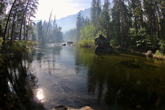
At the bottom of Kings Canyon you find the Kings River. CA-180 follows the south fork for ten miles or so before turning back on itself and forcing you to drive the other direction. The river is sparkling and pure, full of rocks and rapids, and good enough trout habitat that I was able spot several fish holding in the current.

We went on a short hike, on fairly level ground. I found it exhausting, and couldn’t understand why.

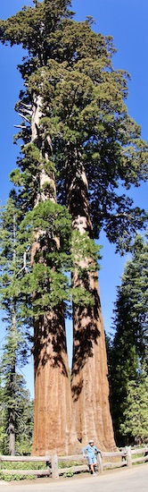
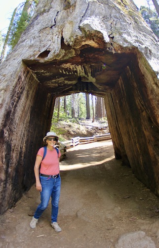
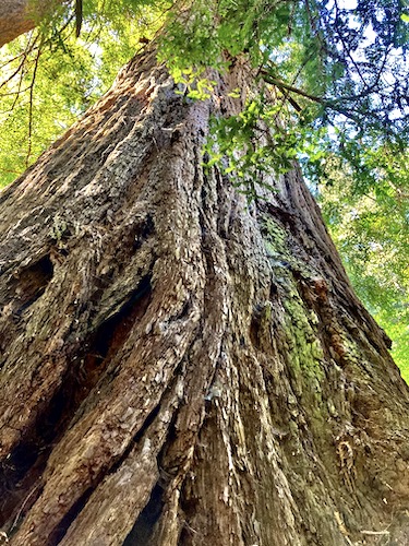
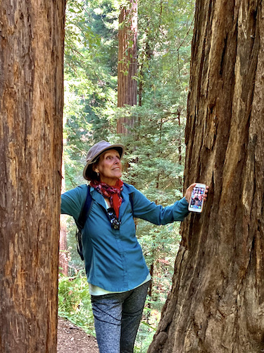
Susan is probably 25 feet away from the base of the tree. This is not the Grant tree!

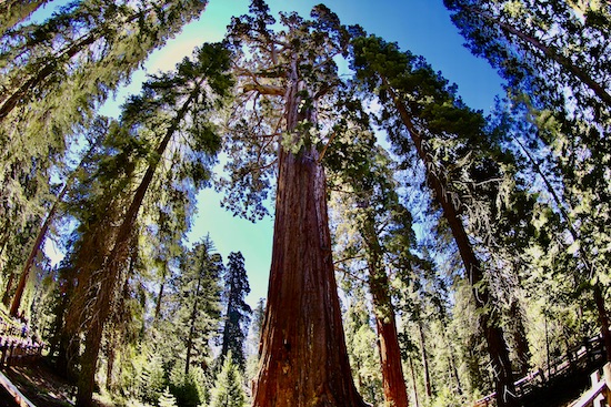
In the morning we went looking at sequoia trees at Grant’s Grove, highlighted by the General Grant tree, the third largest tree on earth. All sequoias are way more than majestic, but this was an incredible example of an extraordinary living thing in its prime! I have no idea how to adequately photograph those sequoias in any way that comes close to doing them justice.

Still no Grant!

I found this walk exhausting, too. Still couldn’t figure it out.

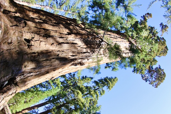
The General Grant tree, only 1700 years old, give or take a few. Young, for a sequoia.

We returned to camp and took a nap. When I woke up I started prepping for dinner and realized I felt awful. A thermometer stuck under my tongue registered 101.3 degrees Fahrenheit. I turned the food prep over to Susan and went and laid down again.

I did not get up for 38 hours. Ouch.

When I felt sort of human again, we did not want to risk complications in a remote area with no cell service. It was horribly disappointing to leave- we hadn’t even been in Sequoia National Park! -but it was the prudent thing to do. We left.

I seem to be recovering as well as could be expected. Thank you for your concern!

Thank you again for reading this week’s post on the Kings Canyon National Park trip cut short. Life is great and I love life! But I hate getting sick!

Every day is a blessing. Don’t waste it- Go fishing! Take a trip! Do SOMETHING!

John Kumiski, author of Fishing Florida by Paddle- An Angler’s Guide

Purchase a signed copy of Fishing Florida by Paddle- An Angler’s Guide at http://www.spottedtail.com/fishing-florida-by-paddle/

All content in this blog, including writing and photos, copyright John Kumiski 2021. All rights are reserved.

Yosemite Park and Muir Woods- A Photo Essay

Yosemite Park and Muir Woods

Thank you for reading this week’s post on Yosemite Park and Muir Woods! I’m glad you’re here!

Now, let me send you somewhere else. This reporter has been writing a travelogue for a website called Global Outdoors. The most recent one they have posted is at this URL- https://blog.globaloutdoors.com/news/2021/5/24/traveling-america-by-van-on-the-road . But the posts go back to planning the trip and building out the van, if you are that interested. The content is quite different than what you see here. If you’re bored at work, please check it out!

Arches on the California coast.

Over the weekend we drove up to Sebastipol to visit Brian and Laura Jaye, long-time friends of Maxx. Maxx took us all out to CA 1 to see the sea. I can hardly believe they put a road on the side of those cliffs. It is terrifying to anyone who fears falling. The scenery is fantastic, though!

Maxx, Catalina, Carlo, and Betty.


General store, Elk, CA.


The flowers along the coast are gorgeous. These are California poppies.

Monday, Susan and I drove from Castro Valley to Yosemite National Park. Once we got clear of the major highways, the drive was beautiful- rolling hills turning into mountains, sparsely travelled four lane highway turning into narrow, winding mountain road.

El Capitan and Half Dome.

We reached the park entrance around noon. At least fifty cars were in line ahead of us.

Susan and John in Tuolumne Grove.

Clearing the entrance gate, we entered the park and drove to the Tuolumne Grove parking lot. I wanted to drive up Tioga Road, but it was closed. We parked, and hiked down into one of only 25 groves of giant sequoias left on the planet. They are so amazing!

A tunnel was carved through this dead tree trunk.

We hadn’t gotten our bearings yet, but after the walk Susan wanted to see El Capitan. We headed towards Yosemite Valley, stopping at overlooks along the way. When we got down onto the valley floor, the road looked like a parking lot. A long line of vehicles were parked on the road, which was temporarily closed for construction We joined the line, and sat down to wait.

After 20 minutes or so, the line started to move. It was slow movement, but it was movement. Hooray!

Our first view of El Capitan was stunning. People climb that cliff?!?!? We managed to snatch a parking spot, and did what tourists do- we snapped photos. That chunk of rock, while amazingly huge and imposing, wasn’t doing much at that moment, so we got back in the car, got back into the traffic, and creeped along- right into a controlled burn.

Didn’t come to see this!

The smoke quickly affected my breathing. You couldn’t see the mountains any more. We turned around as quickly as we could and got out of there.

Smoke filled Yosemite Valley.

Entrance into the park Tuesday morning was easy- no wait! The valley was completely filled with smoke, so after a 45-minute wait due to road construction (I photographed Mercer River while waiting), we drove up onto the Glacier Point road (on another terrifying mountain road) and drove all the way to the Glacier Point overlook.

Mercer River. Methinks there might be many trout here.


Mercer River, view 2. Note the cars parked on the road, left side.


Susan at Glacier Point. The view? AMAZING.

In the meantime, the wind had come up and blown most of the smoke out of the valley. The views from Glacier Point were incredible. We stopped at a couple other overlooks, then hiked up Sentinel Dome.

Sentinel Dome.

This walk was very tough for me. We were at such high elevation, I just couldn’t get enough air. Slow, slow, slow going, but finally I got up there.

Susan and John, somewhere in Yosemite.

The view, of 360 degrees, was dizzying. I hardly took any pictures- no way could they begin to convey the experience. The struggle up there was so worth it!

A view of the Half Dome.

We sat on the dome for over an hour. Some mental arithmetic told me that if we left right now, we’d be back to Castro Valley around sunset. We hiked back (it’s so much easier going down!) and hit the road. My phone took us through the backest roads (is backest a word?) imaginable, but got us to the interstate. We got to Maxx’s about 1930 hours after an amazing couple of days.

A redwood tree. Yes, they are very big, too.

Thursday, we hit a much closer target, Muir Woods National Monument, home of coastal redwood trees. Redwoods lack the bulk of giant sequoias, but they go straight up, seemingly forever. And it’s not like they’re small!

Redwood sorrel carpets the ground in places.


Susan admires some trees…

We took a leisurely hike of two miles or so, then went to Fish., in Sausalito, for lunch. Squid Caesar salad and squid over linguini, it was so good!

Lunch!

Then, it was off to Marin Headlands for views of the Golden Gate Bridge, San Francisco, and the Pacific Ocean. Great stuff! Beautiful spot, and fantastic (if breezy) weather!

The Golden Gate Bridge, icon of San Francisco.

The plan for Saturday is to visit San Francisco. Should be an interesting day!

Thank you for reading this week’s post on Yosemite Park and Muir Woods!

Life is great and I love life!

Every day is a blessing. Don’t waste it- Go fishing! or take a trip!

John Kumiski, author of Fishing Florida by Paddle- An Angler’s Guide

Purchase a signed copy of Fishing Florida by Paddle- An Angler’s Guide at http://www.spottedtail.com/fishing-florida-by-paddle/

All content in this blog, including writing and photos, copyright John Kumiski 2021. All rights are reserved.